4.4 miles
Distance
1,613 ft
Climb
-309 ft
Descent
01:42:45
Avg time

3D
Trail Conditions
- Unknown
- Snow Groomed
- Snow Packed
- Snow Covered
- Snow Cover Inadequate
- Freeze/thaw Cycle
- Icy
- Prevalent Mud
- Wet
- Variable
- Ideal
- Dry
- Very Dry
Trail Flow (Ridden Direction)
Trailforks scans users ridelogs to determine the most popular direction each trail is ridden. A good flowing trail network will have most trails flowing in a single direction according to their intension.
The colour categories are based on what percentage of riders are riding a trail in its intended direction.
The colour categories are based on what percentage of riders are riding a trail in its intended direction.
- > 96%
- > 90%
- > 80%
- > 70%
- > 50%
- < 50%
- bi-directional trail
- no data
Trail Last Ridden
Trailforks scans ridelogs to determine the last time a trail was ridden.
- < 2 days
- < 1 week
- < 2 weeks
- < 1 month
- < 6 months
- > 6 months
Trail Ridden Direction
The intended direction a trail should be ridden.
- Downhill Only
- Downhill Primary
- Both Directions
- Uphill Primary
- Uphill Only
- One Direction
Contribute Details
Colors indicate trail is missing specified detail.
- Description
- Photos
- Description & Photos
- Videos
Trail Popularity ?
Trailforks scans ridelogs to determine which trails are ridden the most in the last 9 months.
Trails are compared with nearby trails in the same city region with a possible 25 colour shades.
Think of this as a heatmap, more rides = more kinetic energy = warmer colors.
- most popular
- popular
- less popular
- not popular
ATV/ORV/OHV Filter
Max Vehicle Width
inches
Radar Time
x
Activity Recordings
Trailforks users anonymized public ridelogs from the past 6 months.
- mountain biking recent
- mountain biking (>6 month)
- hiking (1 year)
- moto (1 year)
Activity Recordings
Trailforks users anonymized public skilogs from the past 12 months.
- Downhill Ski
- Backcountry Ski
- Nordic Ski
- Snowmobile
Jump Magnitude Heatmap
Heatmap of where riders jump on trails. Zoom in to see individual jumps, click circles to view jump details.
Trails Deemphasized
Trails are shown in grey.
Only show trails with NO bikes.
Save the current map location and zoom level as your default home location whenever this page is loaded.
Save4000ft
3000ft
2000ft
0.00miles
0.65miles
1.30miles
1.95miles
2.60miles
3.25miles
3.90miles
Supporters, Builders, Maintainers & Land Managers of Ape Canyon Trail
USFSLand Manager
Ape Canyon Trail Details
-
Activities
- Mountain Bike
- Hike
- Trail Running
-
Riding AreaMt. St. Helens National Volcanic Monument
Amboy, Washington -
Difficulty Rating
-
Trail TypeSingletrack
-
Bike TypeXC
-
DirectionBoth Directions
-
Climb DifficultyBlue
-
Physical RatingModerate
-
Dogs AllowedYes
-
eBike Allowed
-
Global Ranking
-
Local Popularity100 in Mountain Biking [+]
- 100 in Trail Running
- 100 in Hiking
-
Land OwnerUSFS
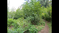
Amazing Ride with Amazing scenery This trail is ridden as an out and back fantastic views of Mount Saint Helens, lava flows, Ape Canyon and of the surrounding area! Ridden as an out and back, it can be extanded by continuing on the Plains of Abraham. The only downfall of this trail is it is an out and back and is popular with hikers, so you need to watch your speed as you will come across other people going both up and down.
Local Trail Association
-

-
Please consider joining or donating to the local trail association to supportdonate to earn trail karma!
trail development & maintenance.
Traditionally Indigenous Territory
More Stats for Ape Canyon Trail mountain bike trail trail
-
Altitude change1,303 ft
-
Altitude min2,876 ft
-
Altitude max4,179 ft
-
Altitude start2,876 ft
-
Altitude end4,180 ft
-
Grade5.6%
-
Grade max-21.3%
-
Grade min48.2%
-
Distance climb3 miles
-
Distance down4,833 ft
-
Distance flat1,650 ft
-
Avg time01:42:45
-
Avg reverse time01:06:22
- view trail stats
close
- Popular Routes
- Ape Canyon Loop
- Mount St. Helens Weekender
- Ape canyon & smith creek loop
- Ape Canyon to Plains of Abraham (IMBA Epic)
- view more routes »
- Trails
Directions to ape-canyon-trail trailhead
(46.165350, -122.091390)
update trails status or condition
Ape Canyon Trail Trail Reports
view all reports »
Recent Ridelog Activity on Trail
Past Week
- 0 rides
6 Months
- 119 rides
- 20 miles avg distance
All
- 726 rides
- Last: Oct 16, 2022

Photos
more »
Routes with this trail
more »
Trail Products
5 Reviews & Comments
-
+ 0
 splanken
Rode this this week. Trail in great condition. Views are epic. Was a mega bloom on the plains.
[Reply]
KRob
 (Oct 5, 2021 at 10:27)
How does Ape Canyon and Plains of Abraham hold up in the rain? Sticky mud or rideable?
[Reply]
karoltu
(Jul 13, 2021 at 22:28)
Lots of steep sections, but an epic reward beyond tree line.
Returning downhill is fun and rolling mostly
[Reply]
Returning downhill is fun and rolling mostly
 lancinho
The road to the trailhead is now open and Ape Canyon and Plains trail are cleared and in good shape.
[Reply]
gafoto
(Aug 2, 2019 at 23:12)
Avoid on the weekends. The traffic makes this pretty mediocre to ride downhill.
[Reply]
Videos
more »


Nearby Trails
- Lava Canyon Trail 1,273 ft
- Nfd 8322 Access Road 4,652 ft
- Smith Creek Trail - River Crossing 3 miles
- Sasquatch Trail 4 miles
- Sasquatch Alternate 5 miles
Mt. St. Helens National Volcanic Monument
Local Weather
Morton
4th Wed

25°F - 31°F
humidity: 97
sunset: 5:35 pm
- 5th Thu
 27°F - 34°F
 - 6th Fri
 29°F - 35°F
 - 7th Sat
 29°F - 35°F

- embed Ape Canyon Trail trail on your website
- By danny & contributors
- #7933 - 13,858 views
- subscribe
- login to download gpx or kml files.